


 Cyclone Yaas
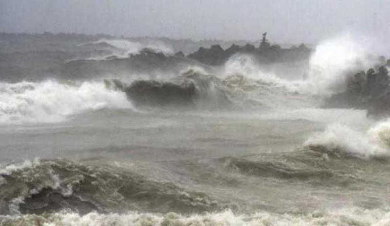
Yaas Cyclone to cause heavy rainfall in Jharkhand too, MET sounds red alert for Southern districts
Ranchi/UNI: The Super Cyclone Yaas is likely to heavily drench the Jharkhand over the next four days from May 25-28 with districts located in the southern areas likely to witness the maximum fury.
For the southern districts of East and West Singhbhum, Simdega and Saraikela which share their borders with West Bengal and Odisha a red alert has been sounded by the MET department.
As per the weather department, the impact of the super cyclone will be felt in the state from Tuesday onwards as in North-Eastern, central and south-eastern regions of the districts of the state along with rainfall thundering and lightning have been predicted with a wind speed of around 40-50 kilometres per hour while some of the areas are likely to witness very heavy rainfall.
On May 26 in southern districts, medium range of rainfall has been predicted with lighting and thundering coupled with a wind speed of 40-50 kilometres per hour reaching up to 80 kilometres per hour.
However, by late evening the wind speed is likely to reach between 110-120 kilometres per hour.
On the other hand in the north and central areas of the state, heavy downpour has been predicted and an orange alert has been sounded while a red alert has been flagged for Southern districts.
On May 27, heavy rainfall has been predicted in north-western and central areas while very heavy rainfall has been predicted for south-eastern regions.
During the day the remaining areas will also witness light to medium range of rainfall with a wind speed of 40-50 kilometres per hour.
On May 28 heavy rainfall has been predicted in the northern areas.
Yaas is very likely to cross north Odisha-West Bengal coasts between Paradip and Sagar islands around noon of May 26 as a very severe cyclonic storm.
Support Our Journalism
We cannot do without you.. your contribution supports unbiased journalism
IBNS is not driven by any ism- not wokeism, not racism, not skewed secularism, not hyper right-wing or left liberal ideals, nor by any hardline religious beliefs or hyper nationalism. We want to serve you good old objective news, as they are. We do not judge or preach. We let people decide for themselves. We only try to present factual and well-sourced news.
Support objective journalism for a small contribution.


