


 CyclonicStorm
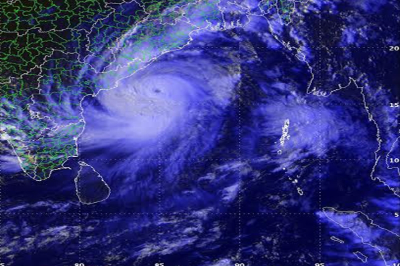
Depression over Bay of Bengal to intensify into Cyclonic storm on May 8: IMD
Kolkata: A depression over Southeast Bay of Bengal and adjoining Andaman Sea is likely to intensify into a cyclonic storm on May 8, IMD sources on Saturday said.
The Well Marked Low Pressure Area over Southeast Bay of Bengal and adjoining Andaman Sea has moved northwestwards, concentrated into a depression and lay centered over over the same region about 1300 km south-southeast of Puri on Saturday.
Met sources said it is very likely to move northwestwards and intensify into a Cyclonic Storm over eastcentral Bay of Bengal on May 8.
The cyclonic storm is very likely to continue to move northwestwards till May 10 evening and reach Westcentral and adjoining Northwest Bay of Bengal off North Andhra Pradesh & Odisha coasts.
Thereafter, it will recurve north-northeastwards and move towards Northwest Bay of Bengal off Odisha coast.
IMD Director Mrutunjaya Mohapatra said the cyclonic storm will not cause any landfall either in Orissa or Andhra Pradesh coast.
Under the impact of the cyclonic storm light to moderate rainfall very likely to commence from May 10 evening at many places over the coastal Odisha districts and Heavy Rainfall (7 -11cm)is very likely to occur at one or two places over Gajapati, Ganjam, and Puri districts.
On May 11 coastal Odisha districts will experience o light to moderate rainfall while rainfall (7-11cm) likely to occur at one or two places over Ganjam, Khordha, Puri,Jagatsinghpur and Cuttack districts.
The Gale wind speed reaching 65-75 kmph gusting to 85 kmph is likely to prevail over central parts of Bay of Bengal on May 9.
The Gale wind speed reaching 80-90 kmph gusting to 100 kmph is likely to prevail around the system center over West Central and adjoining Northwest & East Central Bay of Bengal on May 10 and 70-80 kmph gusting to 90 kmph over northwest and adjoining Westcentral Bay of Bengal on May 11 next Squally wind speed reaching 40-50 kmph gusting to 60 kmph is likely along and off Odisha coast.
The sea condition will become high over central parts of bay of bengal on May 9 and over west central & adjoining northwest and east central bay of bengal on May 10.
The fishermen are advised not to venture into the deep sea area over the central bay of Bengal on May 9 and May 10 and over northwest bay of Bengal on May 10.
The fishermen who have gone to sea are advised to return to the coast by May 10 .
Sources said a flood situation may likely occur and water logging may arise in low lying areas .The state government had already alerted the district collectors to chalk out strategies to meet any eventuality.
Support Our Journalism
We cannot do without you.. your contribution supports unbiased journalism
IBNS is not driven by any ism- not wokeism, not racism, not skewed secularism, not hyper right-wing or left liberal ideals, nor by any hardline religious beliefs or hyper nationalism. We want to serve you good old objective news, as they are. We do not judge or preach. We let people decide for themselves. We only try to present factual and well-sourced news.
Support objective journalism for a small contribution.


