India says Nepal Parliament's clearing of revised map 'not tenable'
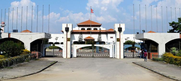
New Delhi/IBNS: After Nepal's Parliament voted on Saturday on a constitutional amendment bill in a special session to revise the country's map, which includes some parts India claims as its own, the Ministry of External Affairs has said the same is not tenable.
The House of Representatives of Nepal on Saturday passed the Constitutional Amendment Bill revising the Coat of Arms of Nepal which has included a stretch of land in the mountains that India claims as its own.
In response to media queries on the passing of Constitutional Amendment Bill by Nepal, MEA Official Spokesperson Anurag Srivastava said, "We have noted that the House of Representatives of Nepal has passed a constitution amendment bill for changing the map of Nepal to include parts of Indian territory. We have already made our position clear on this matter."
"This artificial enlargement of claims is not based on historical fact or evidence and is not tenable. It is also violative of our current understanding to hold talks on outstanding boundary issues," he said.
Out of the 275 members of Nepal's House of Representatives, 258 votes went in favour of the amendment bill, which was passed by a two-thirds majority.
Last month, Nepal's ruling party had cleared the map paving the way for friction between the two countries.
Now that the bill has been passed, it will be sent to the National Assembly where it will undergo a similar process.
The new map of Nepal includes a portion of land on the east of river Kali, which extends out from the northwestern tip of Nepal.
The area includes the Lipulekh Pass in Uttarakhand and also Limpiyadhura and Kalapani, which are strategically significant areas for India and the country has been guarding since the 1962 war with China.
Earlier, Nepal had condemned India's construction of a new road through the Lipulekh pass in Uttarakhand, that is claimed by the Kathmandu government.
Nepal had condemned India's "unilateral act" that "runs against the understanding reached between the two countries... that a solution to boundary issues would be sought through negotiations."
Support Our Journalism
We cannot do without you.. your contribution supports unbiased journalism
IBNS is not driven by any ism- not wokeism, not racism, not skewed secularism, not hyper right-wing or left liberal ideals, nor by any hardline religious beliefs or hyper nationalism. We want to serve you good old objective news, as they are. We do not judge or preach. We let people decide for themselves. We only try to present factual and well-sourced news.


