UN agency uses satellite data to aid farmers in Africa, Middle East boost water efficiency
“Water use continues to surge at the same time that climate change – with increasing droughts and extreme weather – is altering and reducing water availability for agriculture,” said Maria Helena Semedo, Deputy Director-General of the UN Food and Agricultural Organization (FAO) Climate Change and Natural Resources.
“That puts a premium on making every drop count, underscoring the importance of meeting growing food production needs from efficiency gains.”
Known as WaPOR, the open-access database measures evapotranspiration – how water evaporates and returns to the atmosphere, according to FAO.
“Evapotranspiration thus provides a direct measure of the water consumed by a crop during a growing season and, when related to the biomass and harvestable crop yield, allows for calculating the crop water productivity,” the UN agency said presenting WaPOR at a high-level meeting in Rome on “ “Coping with water scarcity in agriculture: a global framework for action in a changing climate”.
WaPOR sifts through data to produce maps that who much food is produced for every cubic meter of water consumed.
FAO, with support from the Government of the Netherlands, is currently focusing on African and the Middle East, with detailed data expected in October for pilot areas in Ethiopia, Lebanon and Mali.
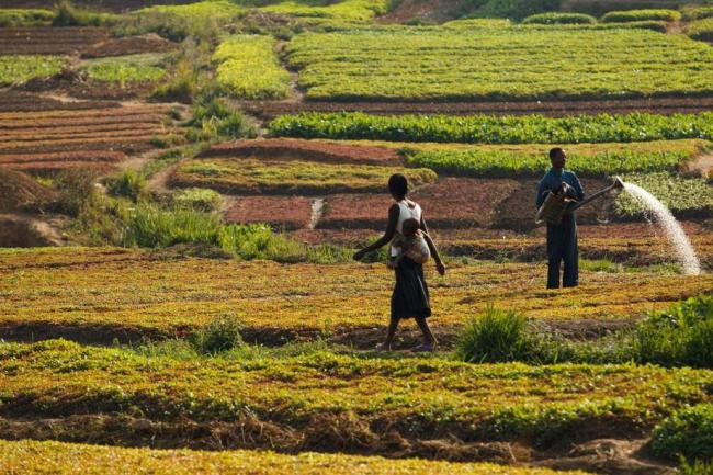
Photo: FAO/Olivier Asselin
Source: www.justearthnews.com
Support Our Journalism
We cannot do without you.. your contribution supports unbiased journalism
IBNS is not driven by any ism- not wokeism, not racism, not skewed secularism, not hyper right-wing or left liberal ideals, nor by any hardline religious beliefs or hyper nationalism. We want to serve you good old objective news, as they are. We do not judge or preach. We let people decide for themselves. We only try to present factual and well-sourced news.
Support objective journalism for a small contribution.