 Tibet
Tibet
Himachal Pradesh hosts ‘Mapping Tibet' exhibition in Dharamshala
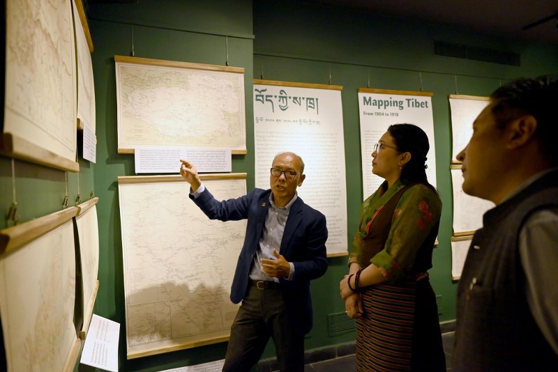
Indian Himalayan state of Himachal Pradesh recently hosted an exhibition titled ‘Mapping Tibet' at the Tibet Museum in Dharamshala town.
The exhibition was inaugurated by Norzin Dolma, Minister of the Department of Information and International Relations of the Tibetan government in exile.
42 maps have been displayed showcasing the historic boundaries of Tibet since the 17th century and its political relationships with the neighbouring countries, reports ANI.
The exhibition, which was inaugurated on Monday, will continue till October 5.
The chief guest of the event was Tsering Wangyal Shawa. He has served as the Geographic Information System (GIS) and Map Librarian at Princeton University Library since 1998.
He presently teaches a course on “GIS for Public Policy” at the Princeton School of Public and International Affairs.
Speaking to ANI, he said: "These maps tell a story about how Tibet was mapped by different agencies over time and so that people will understand how Tibet mapping was evolved over time so that is the whole idea here and at the same time we want the general public to understand what Tibet is and how the mapping of Tibet was evolved over time so that they can have a better understanding.”
Support Our Journalism
We cannot do without you.. your contribution supports unbiased journalism
IBNS is not driven by any ism- not wokeism, not racism, not skewed secularism, not hyper right-wing or left liberal ideals, nor by any hardline religious beliefs or hyper nationalism. We want to serve you good old objective news, as they are. We do not judge or preach. We let people decide for themselves. We only try to present factual and well-sourced news.
Support objective journalism for a small contribution.